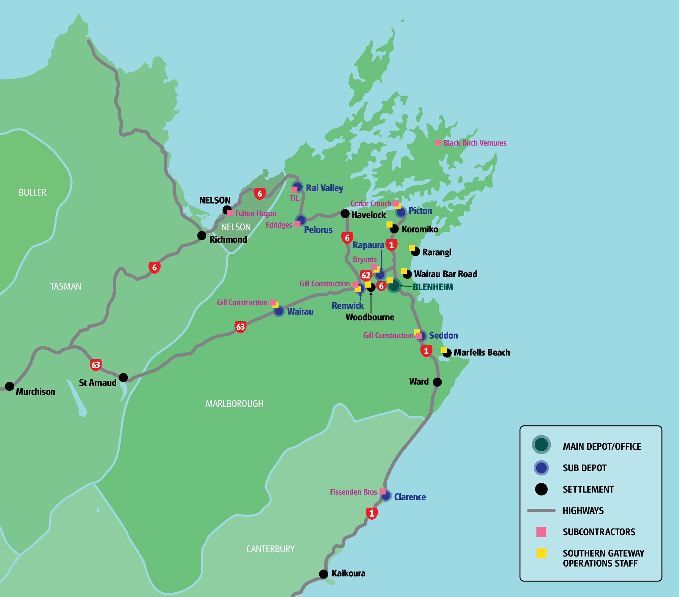
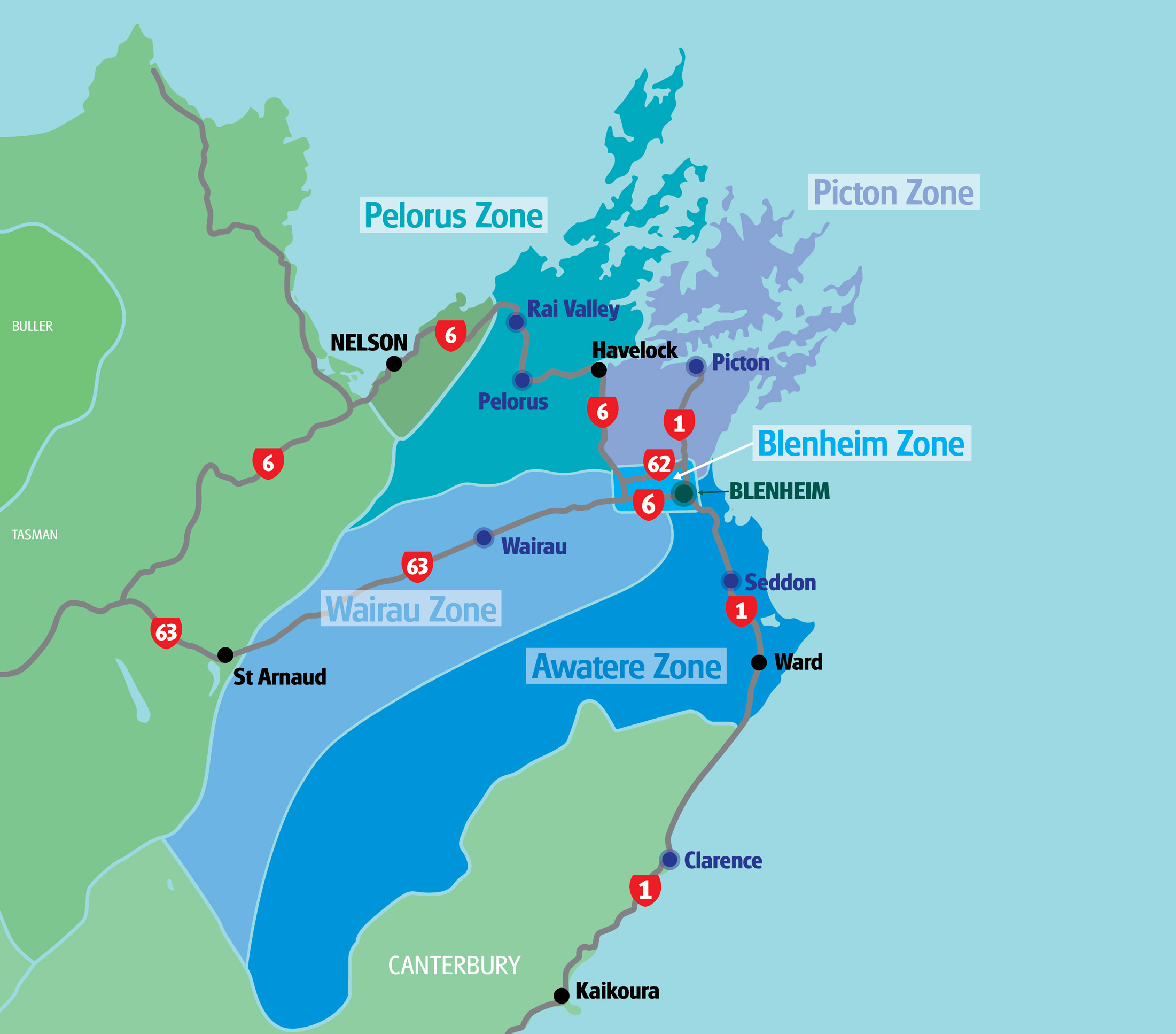
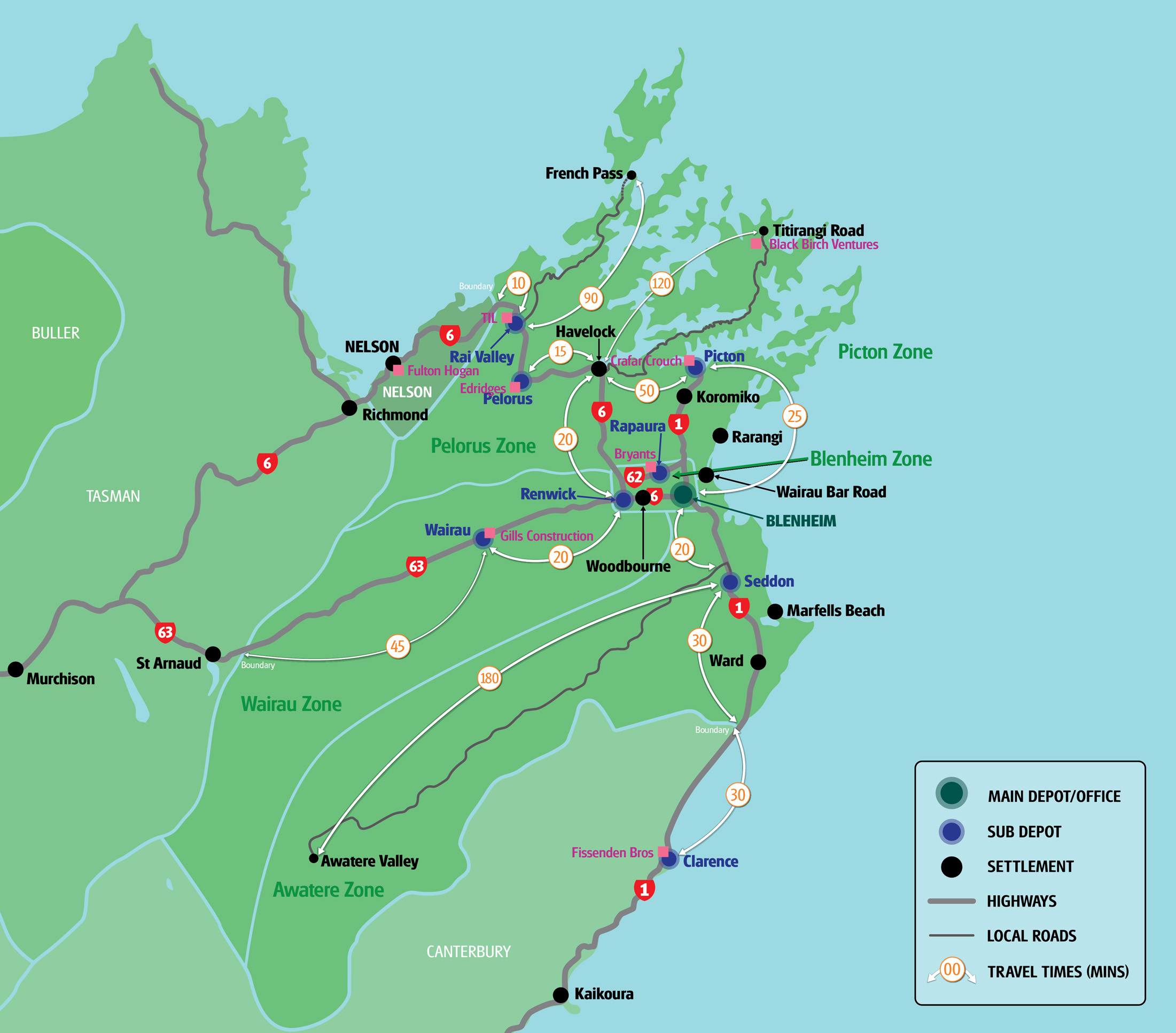
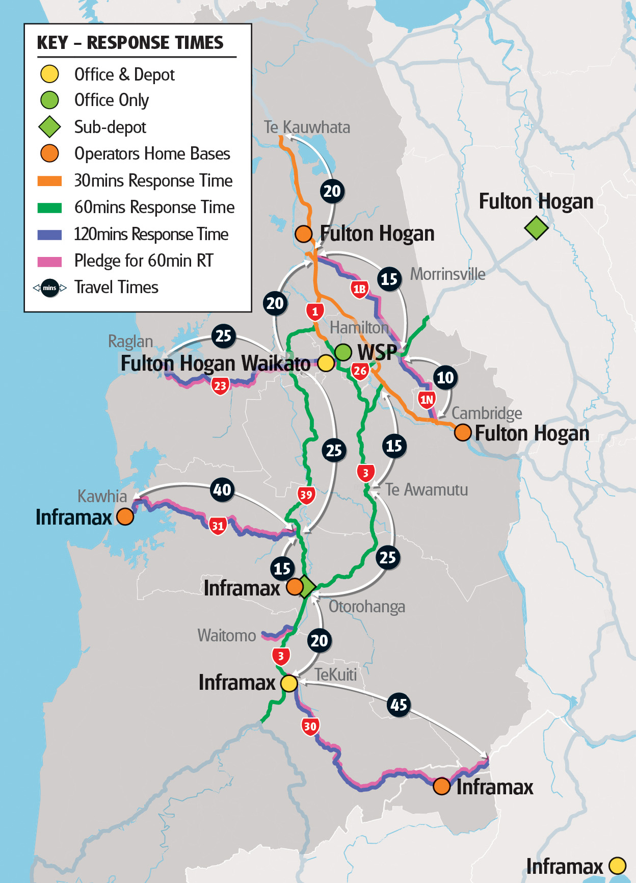
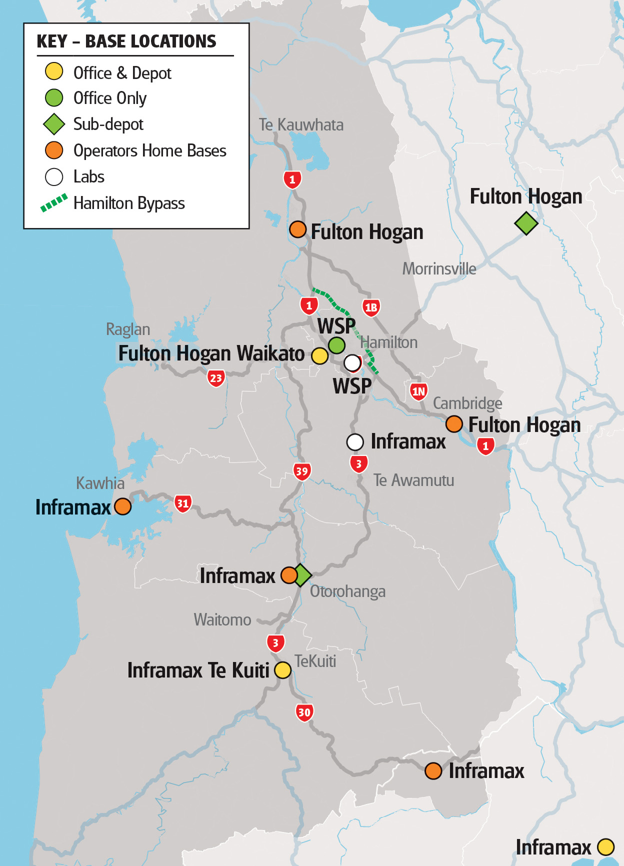
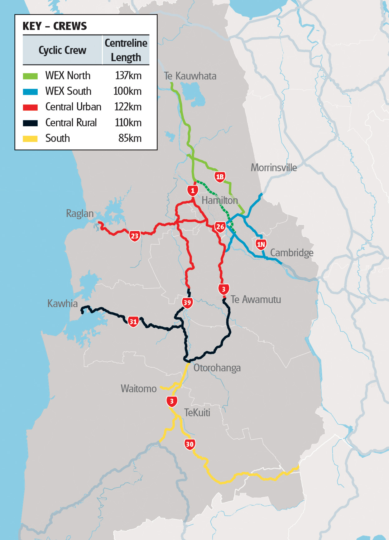
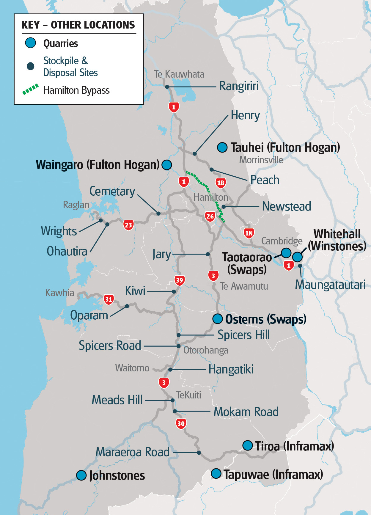
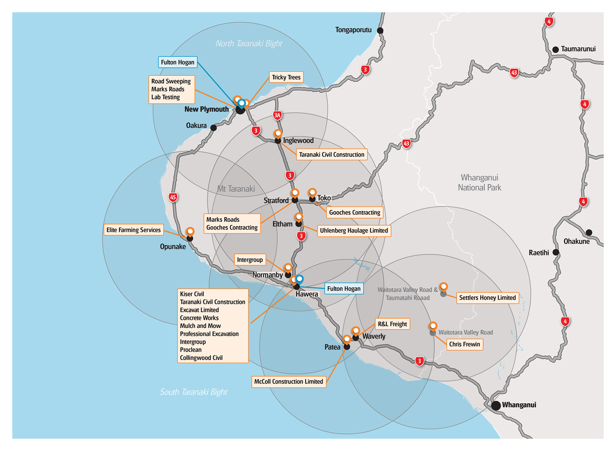
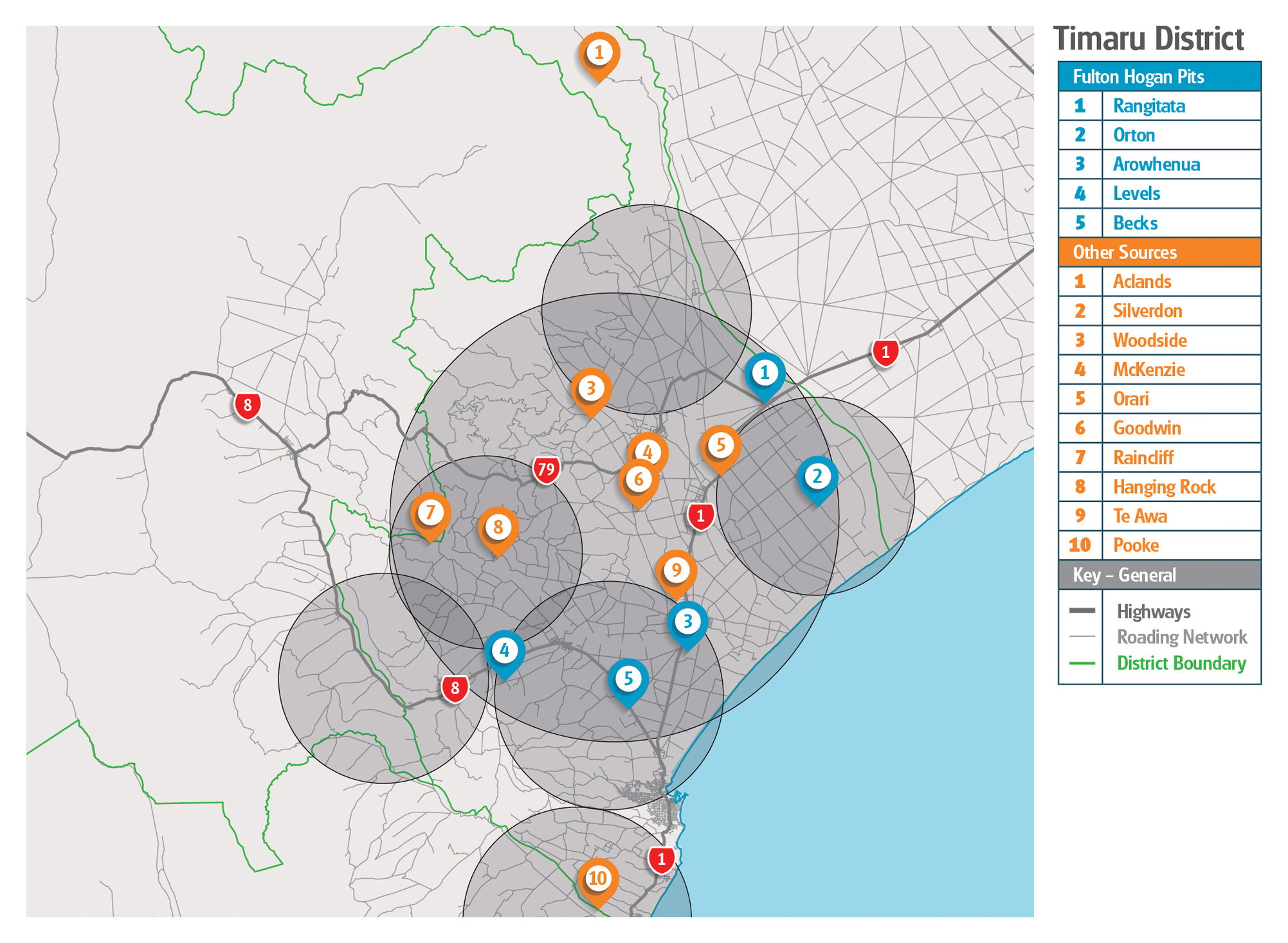
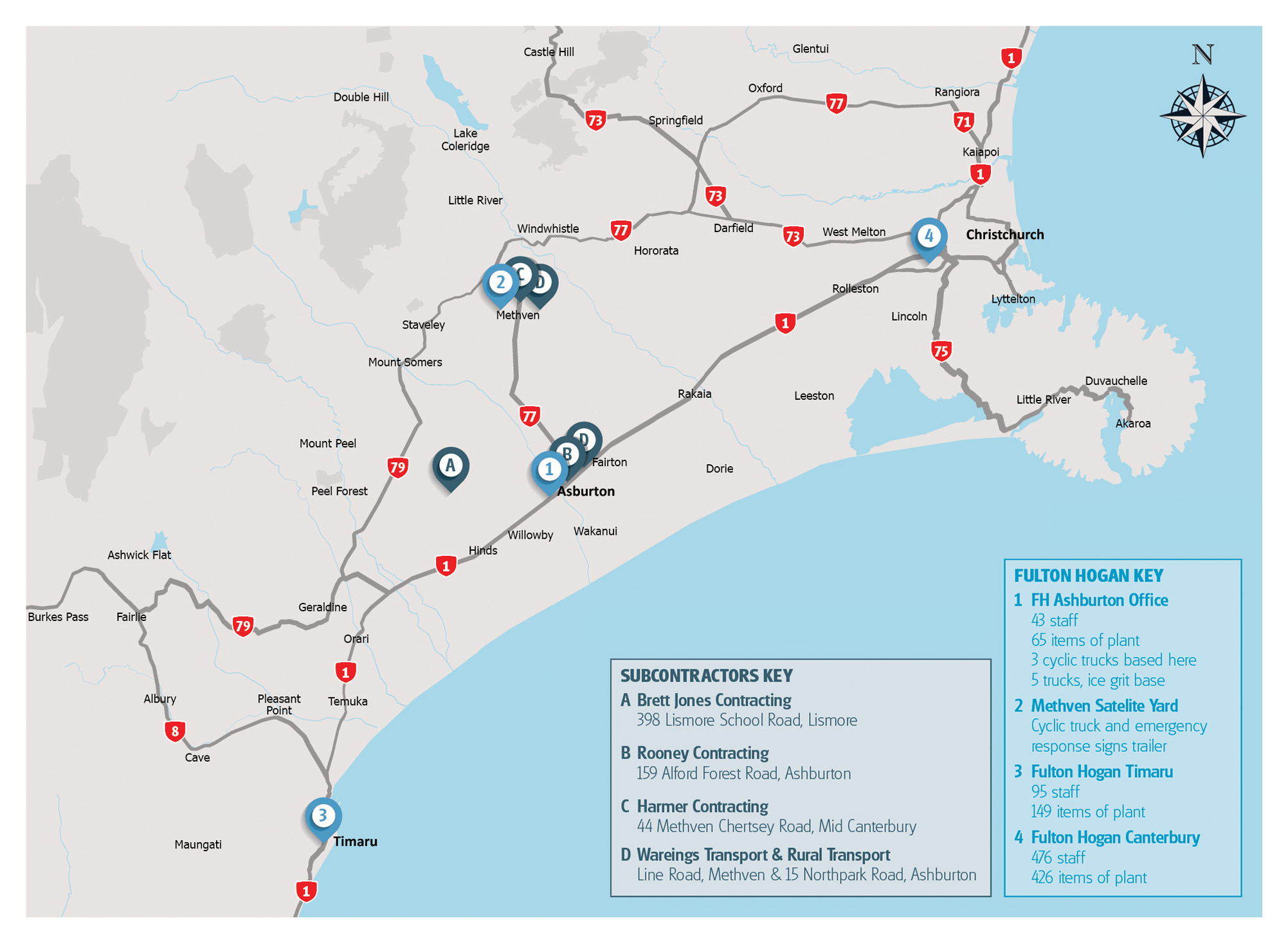
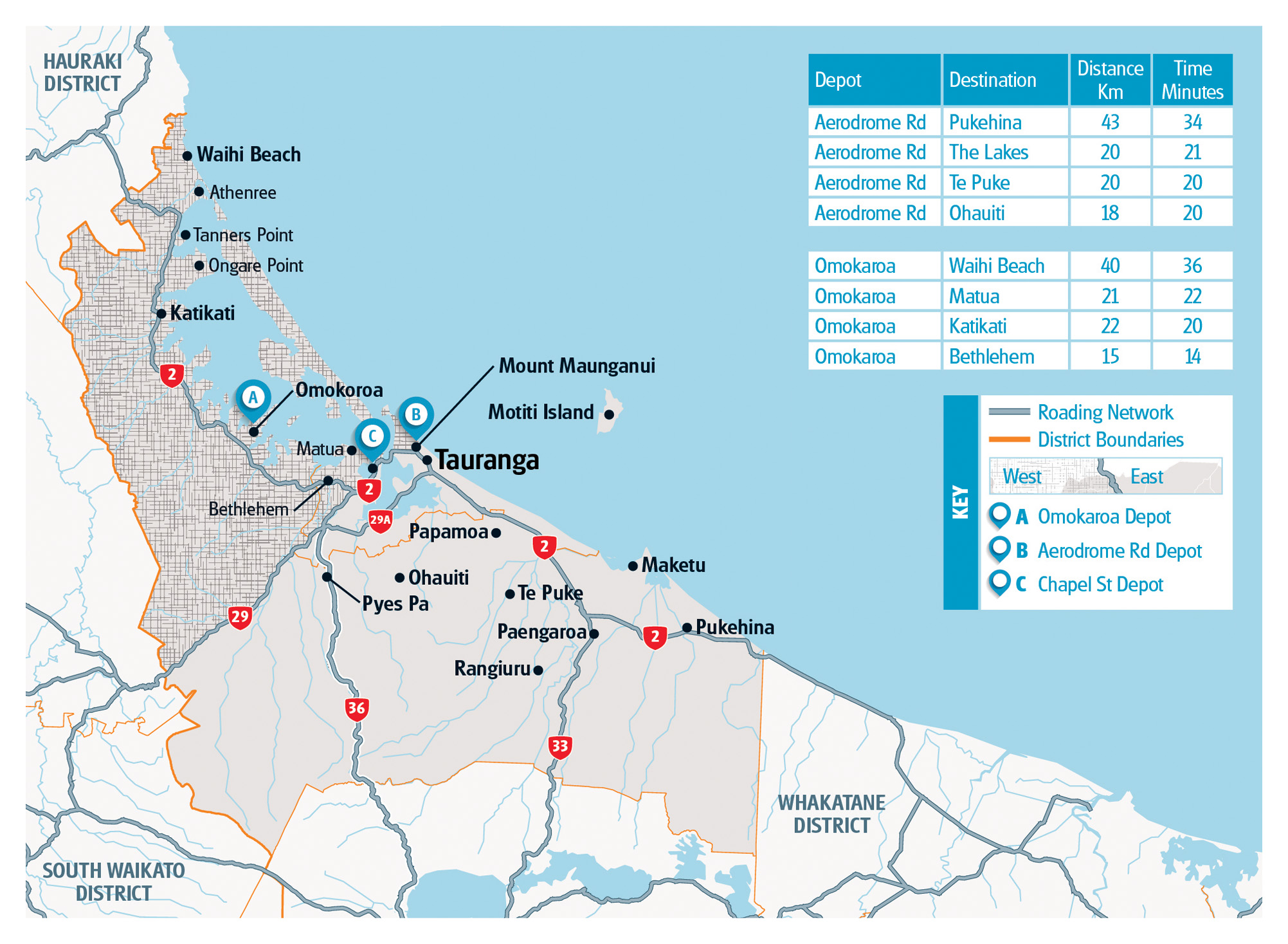
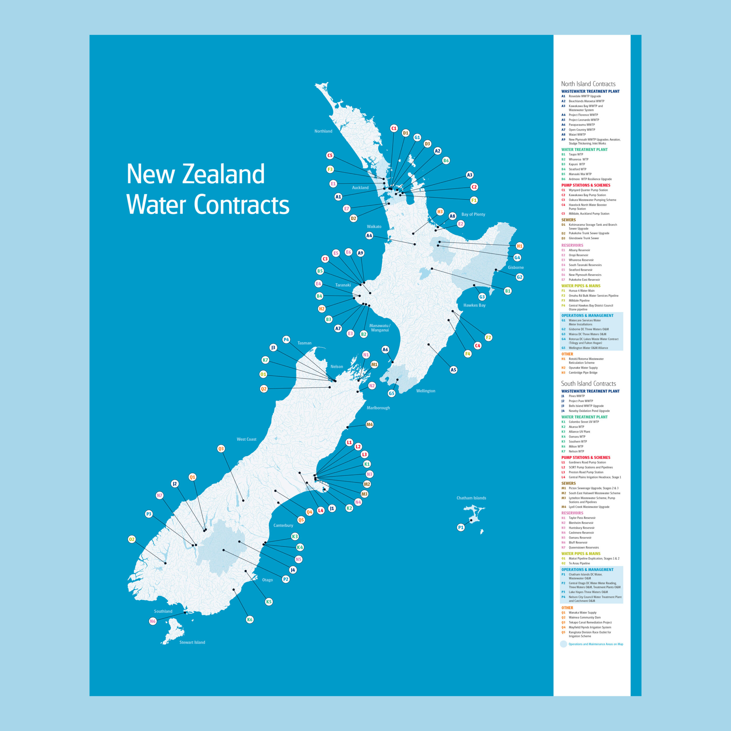
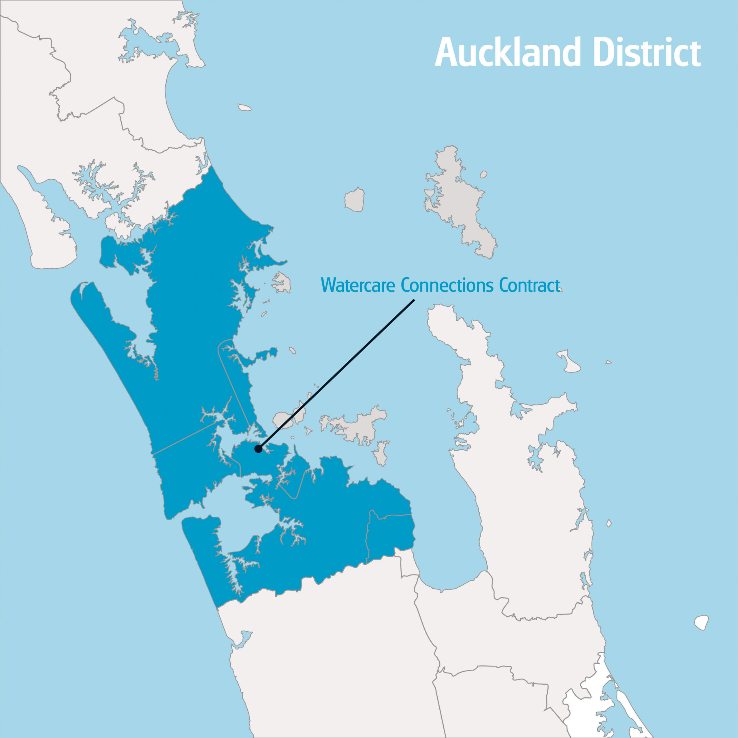
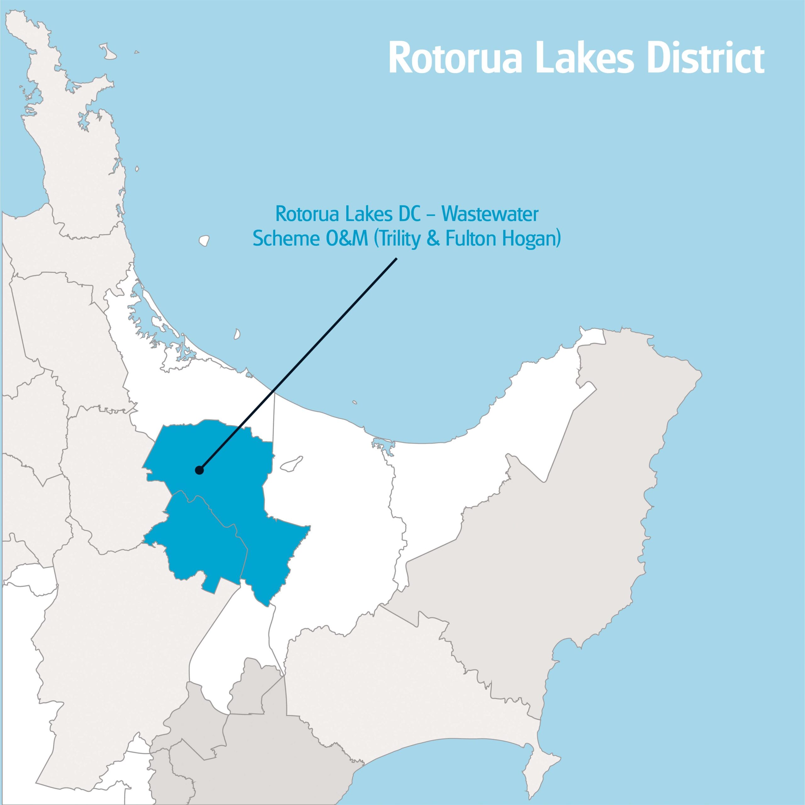
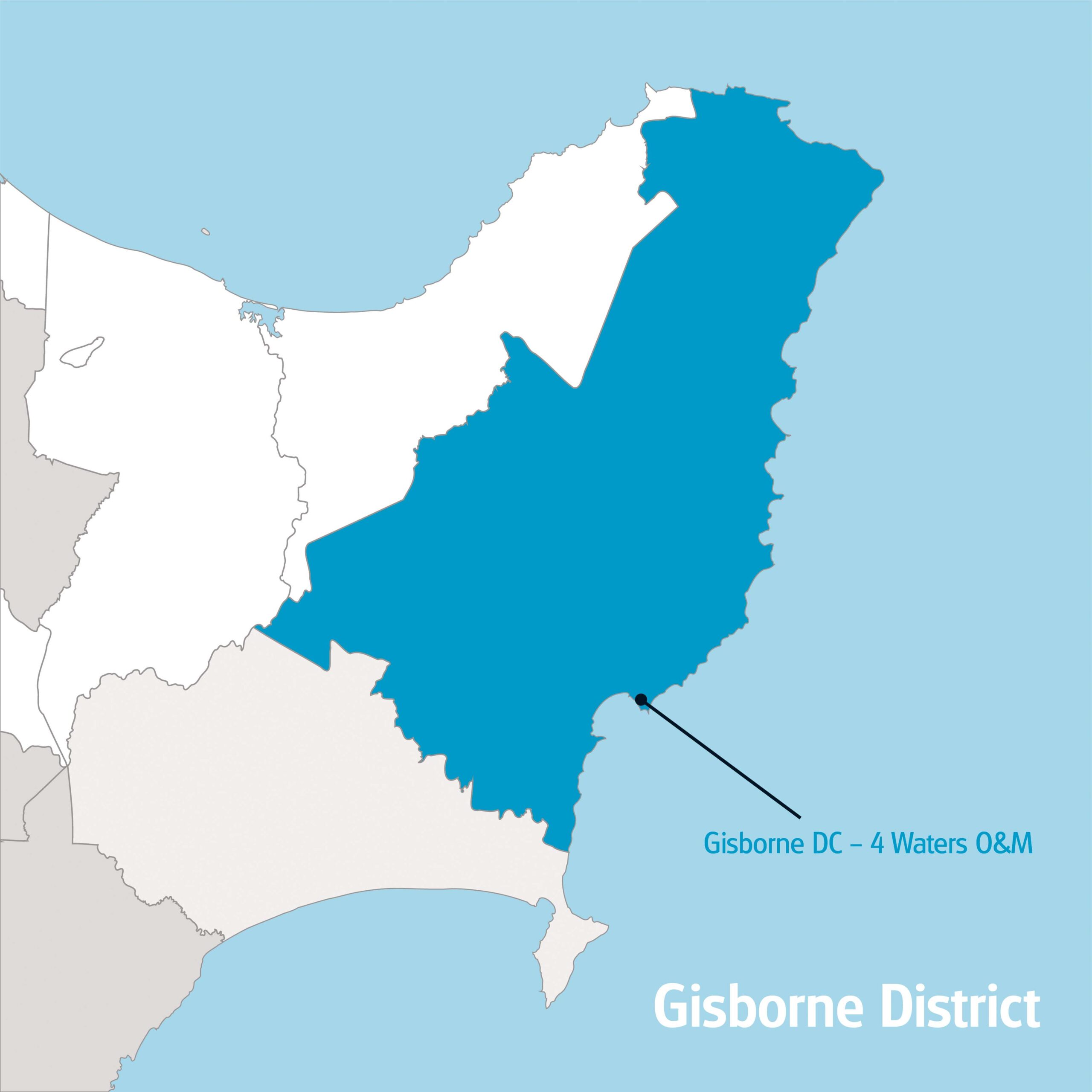
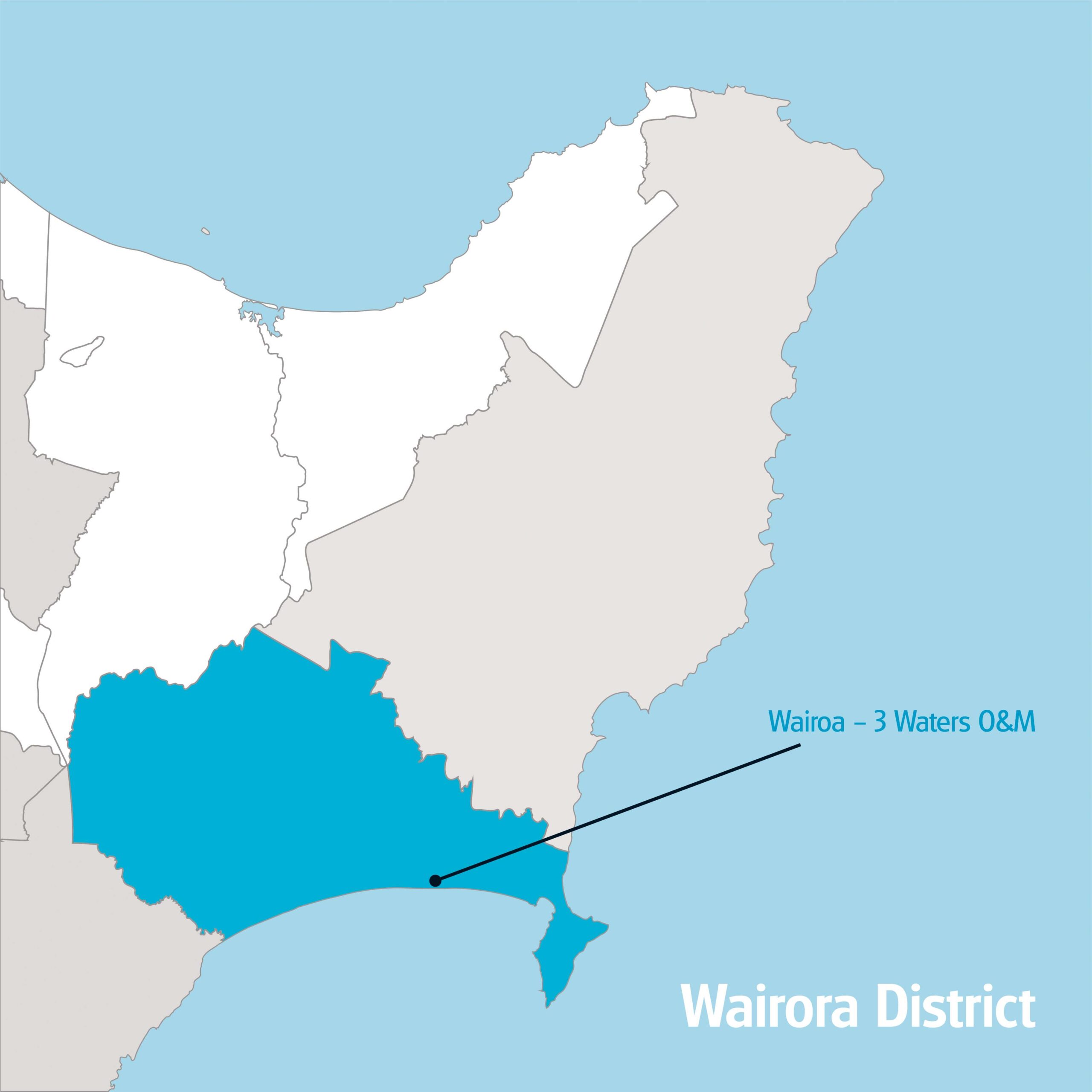
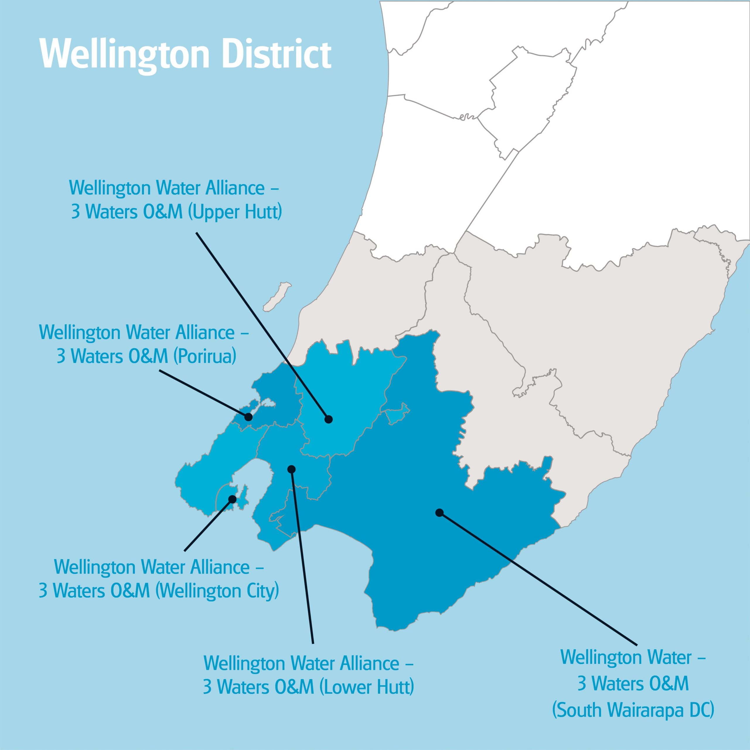
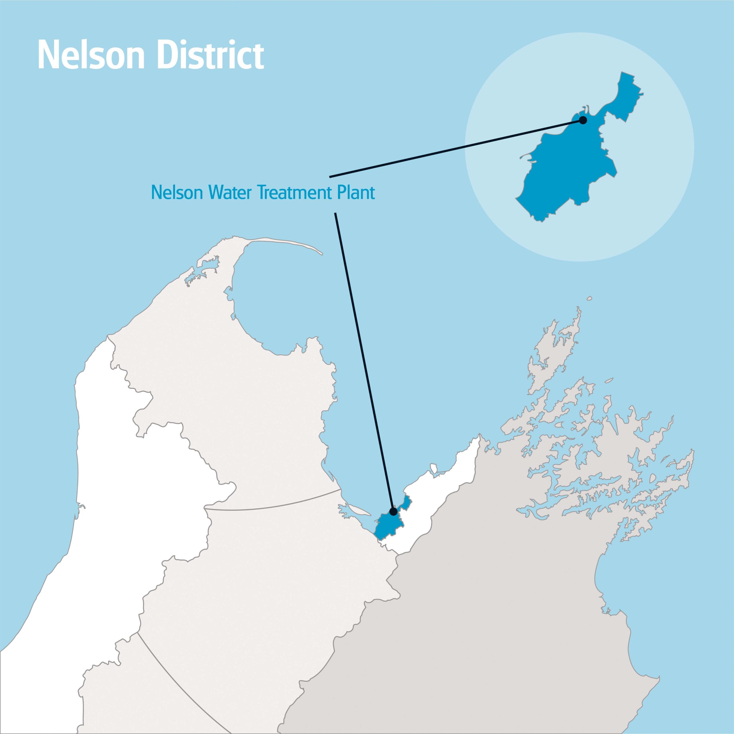
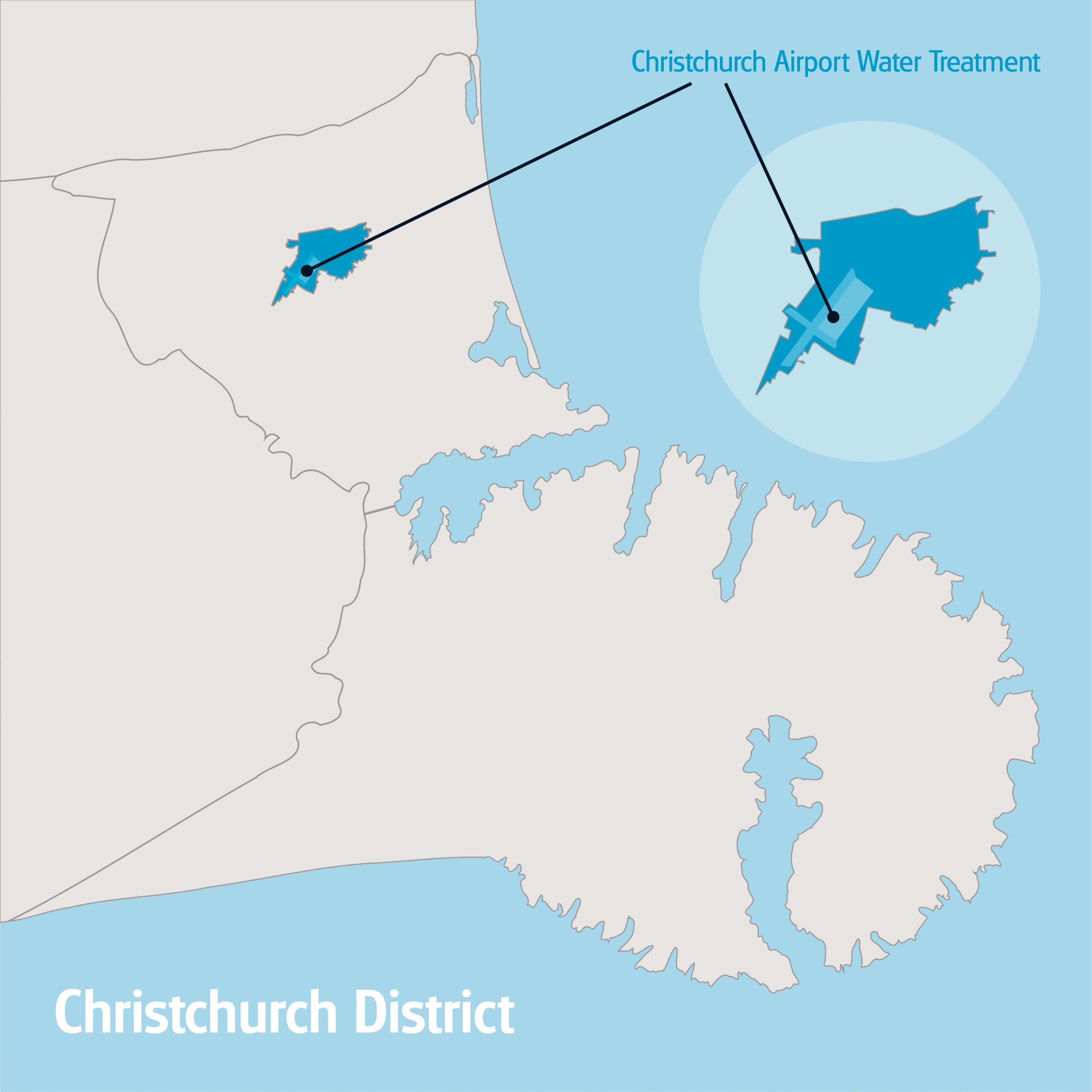
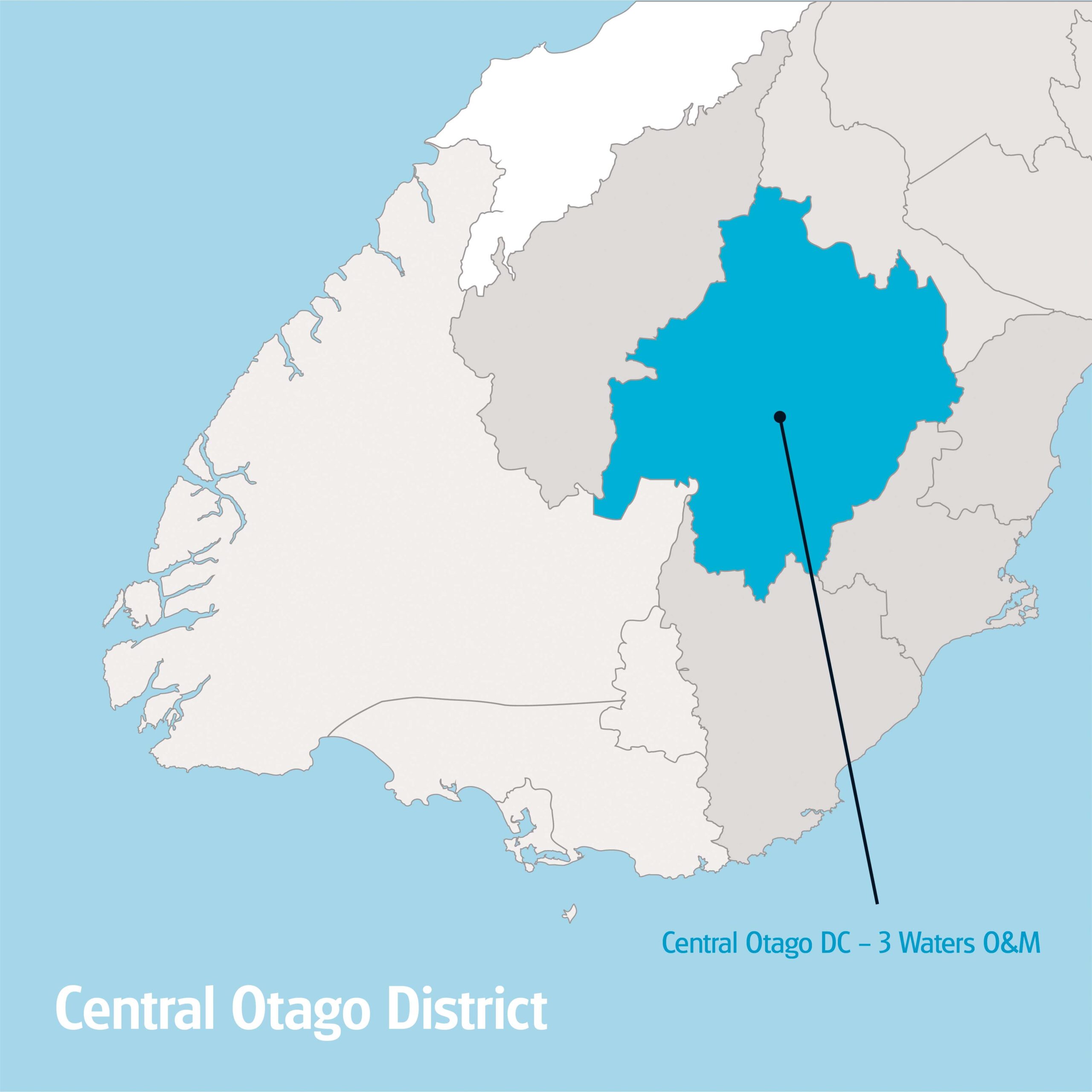
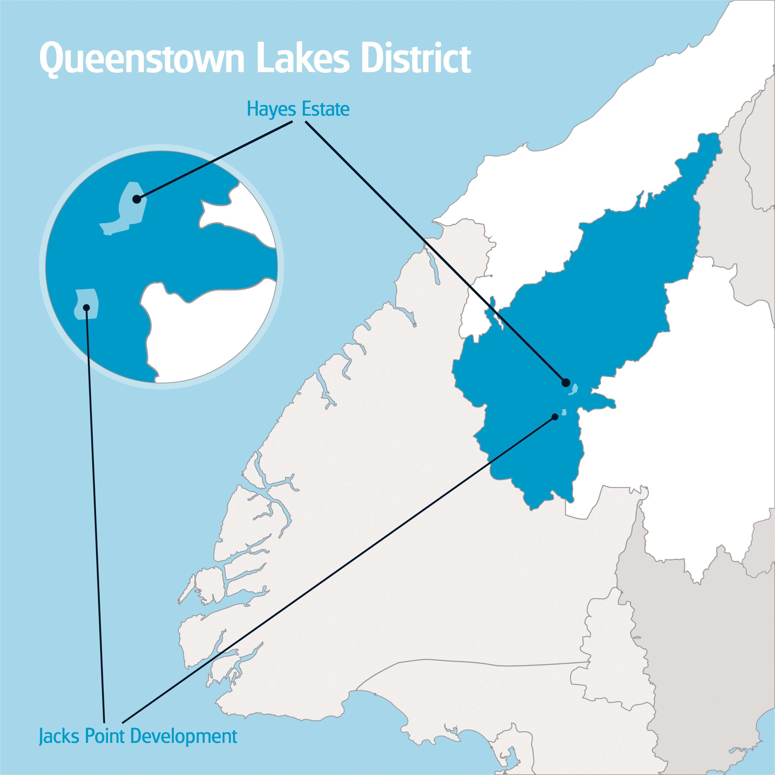
For several projects I created various of maps that required specific markups and layers, tailored to the task at hand. With the use of GIS Vector Basemaps, I was produced maps for the required NZ regions and areas with the necessary roading information. Afterwards, these were imported into Adobe Illustrator, this would allow me to expand the vector artwork elements, organise them into layers and mark them up accordingly. The final maps designs were displayed within various documents, PowerPoint slides and tendering submissions.